
About the Project & Creator
IcelandBusMap.com is an independent community project created by a 20-year-old solo budget traveler and developer (who has visited over 30 countries). While planning an Icelandic backpacking trip, they found the text-based Strætó route planner hard to visualize and remember stop names. To solve this, they built this interactive map application to help other visitors easily explore the country by bus. The project is maintained solely by the developer and is updated with new features and timetable revisions regularly.
Affiliation Disclaimer: This project is completely independent. It is not affiliated with, endorsed by, or sponsored by Strætó bs., the official transport operator of Iceland.
Data Accuracy, Sources & Update Frequency
Providing accurate and current transit information is our highest priority. The map and routing system are generated using the official public GTFS (General Transit Feed Specification) datasets published by Strætó. The static timetable files and route paths are synchronized and refreshed every 1 to 2 weeks (latest database update: July 16, 2026) to reflect current summer/winter schedules, temporary detour changes, and operator updates.
Live Weather & Road Alerts: Real-time alerts are polled from the Icelandic Meteorological Office (Vedur.is). These Common Alerting Protocol (CAP) messages and road safety advisories are translated and automatically linked to specific Strætó route lines, displaying warnings like Suspended, High Risk, or Weather Warning directly on the interface.
Original Value & Unique Features
This planner offers several features not found in standard transit searches:
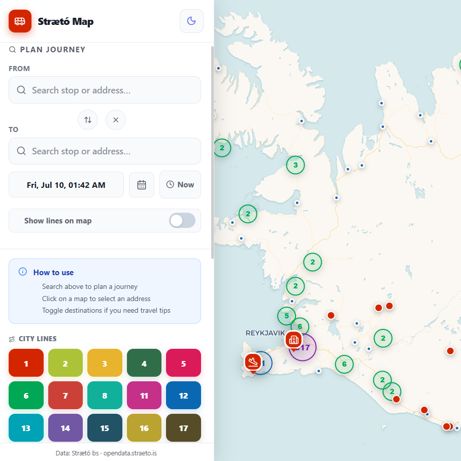
- Interactive Visual Layout: View every single city route in Reykjavík and rural countryside routes on a high-speed leaflet map.
- Address Route Search: Search for any address in Iceland. The system automatically locates the closest bus stops and displays which routes run from those stops, allowing tourists to plan trips without knowing stop names beforehand.
- Offline View Support: Load the web app while online, and you can travel into the wild or rural areas without mobile data. The map and route database will continue to work offline (except for live weather alerts).
- Interactive Map Embeds: Travel blogs, hotels, and hostels can embed this map directly on their websites to show their guests how to reach them. See the widget configurations under the "About" section in the sidebar.
- Fare Calculation (Beta): Calculates estimated trip prices (currently 90% accurate, actively being calibrated to 100%).
Usage limitations & Safety Guidelines
Please note that IcelandBusMap.com is a planning tool designed for visual guidance. Because public transport in Iceland is heavily affected by sudden winter storms, high winds, and road closures, users should always cross-reference timetables and safety warnings with the authoritative operator at Strætó (straeto.is) and check live road conditions at Umferðin (umferdin.is) before traveling.
Popular Transfer Links
Click these direct routes to pre-load connections on the map planner:
- Keflavík International Airport (KEF) to Reykjavík BSÍ (Bus Line 55)
- Reykjavík BSÍ to Keflavík International Airport (KEF) (Bus Line 55)
- Keflavík International Airport (KEF) to Blue Lagoon (Transfer Planner)
- Reykjavík to Blue Lagoon (Bus & Transfer Planner)
- Reykjavík to Gullfoss Waterfall (Golden Circle Route Planner)
- Reykjavík to Thingvellir National Park (Golden Circle Guide)
Strætó Country & City Bus Lines
Explore stops, timetables, and maps for main Iceland transit routes:
- Line 55: KEF Airport → Reykjavík
- Line 55: Reykjavík → KEF Airport
- Line 51: Reykjavík → Akureyri
- Line 51: Akureyri → Reykjavík
- Line 57: Akureyri → Egilsstaðir
- Line 57: Egilsstaðir → Akureyri
- Line 1: Skúlagata → Skarðshlíð
- Line 2: Háskóli Íslands → Mjódd
- Line 3: Grandi → Mjódd
- Line 4: Skúlagata → Mjódd
Popular Icelandic Attractions by Bus
Find out how to get to these famous spots using public transportation:
- Show Blue Lagoon on Map
- Show Gullfoss Waterfall on Map
- Show Geysir Geothermal Area on Map
- Show Thingvellir National Park on Map
- Show Reynisfjara Black Sand Beach on Map
- Show Skógafoss Waterfall on Map
- Show Seljalandsfoss Waterfall on Map
- Show Jökulsárlón Glacier Lagoon on Map
- Show Diamond Beach on Map
- Show Akureyri on Map
Official Reykjavík Tour Bus Stops (1-14)
For sightseeing day tours and airport transfers in downtown Reykjavík, locate your designated pickup point:
Live Weather & Route Suspension Alerts
Our interactive planner integrates real-time CAP weather warnings and road closures from Vedur.is directly mapped to Strætó bus routes. Stay safe with dynamic route suspension badges (Suspended, High Risk, or Weather Warning) highlighted on our map and sidebar route directory before you travel.